How far you can see underwater depends primarily on how much light is attenuated by the water and what is in suspended in it, readily measured by the quantity Kd490, and by the concentration of chlorophyll. These quantities can be estimated from satellite spectral sensors, which is why I use the products from the two MODIS satellites.
Validating the visibility algorithm is challenging for two reasons. First there is no standard universally accepted definition of how to objectively define visibility. And secondly there is very little data. Rainbow Reef Dive Center of Key Largo, Florida is an exception; they have consistently recorded the visibility for its dives since 2013. Using the subjective estimates of visibility made by the divemasters one can compare their observations against the algorithm. Except there is another twist. Each satellite is slighlty different and the estimates of Kd490 and [chla] are different, which leads to different visibility estimates.
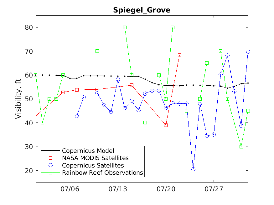
The following figure shows the visibility at the Spiegel Grove during July 2025.

Should you have any questions, please Contact Us